Maps
Biblica’s Open Bible Maps (2019), 15 maps
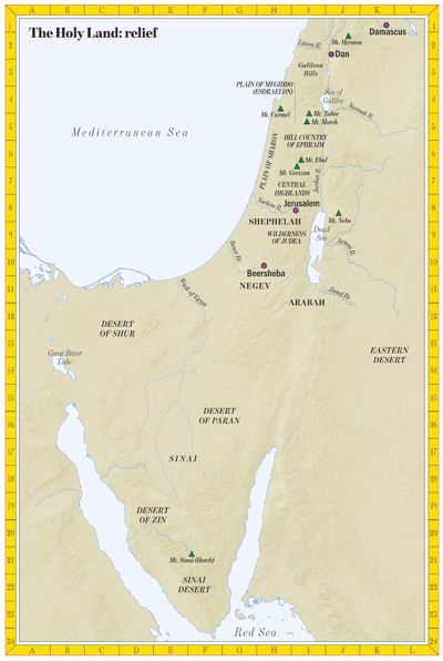 The Holy Land 15 places
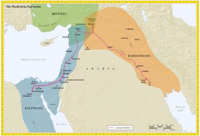 The World of the Patriarchs 17 places
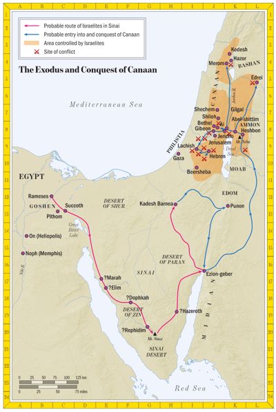 The Exodus and the Conquest of Canaan 31 places
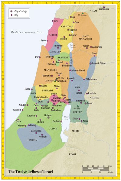 The Twelve Tribes of Israel 61 places
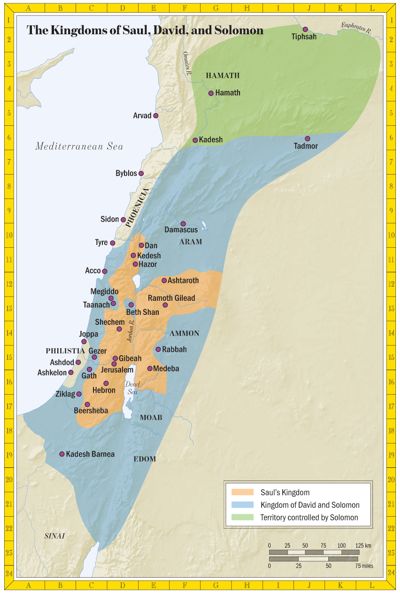 The Kingdoms of Saul, David and Solomon 35 places
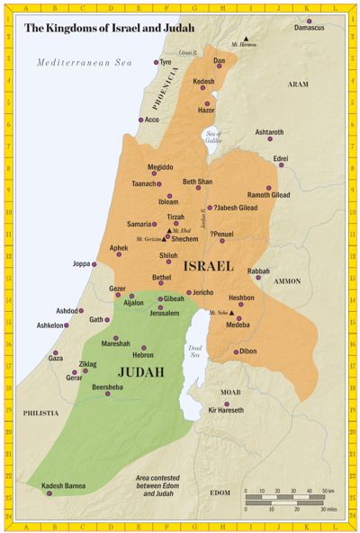 The Kingdoms of Israel and Judah 46 places
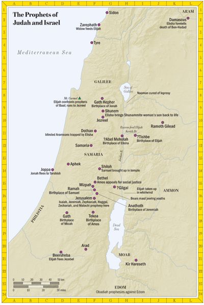 The Prophets of Judah and Israel 29 places
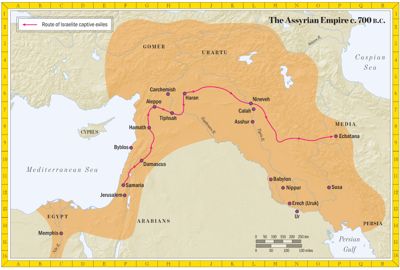 The Assyrian Empire, about 700 BC 14 places
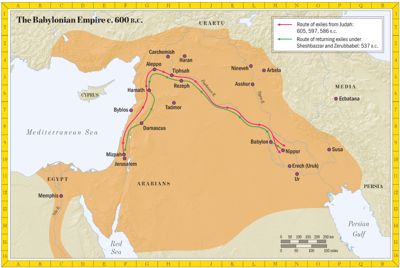 The Babylonian Empire, about 600 BC 19 places
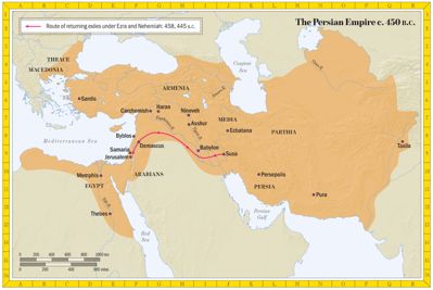 The Persian Empire, about 450 BC 12 places
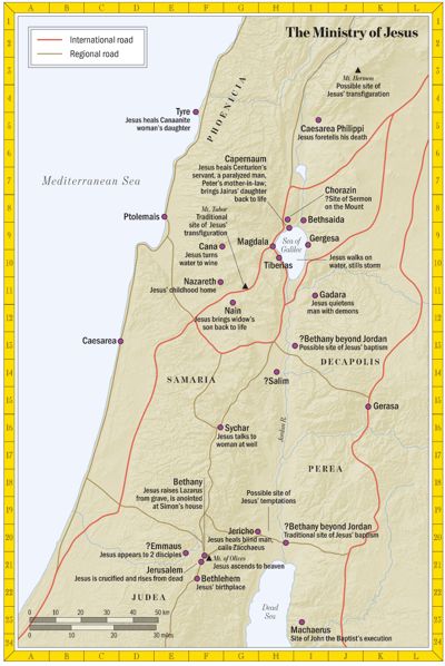 The Ministry of Jesus 20 places
 Jesus’ Final Week in Jerusalem 4 places
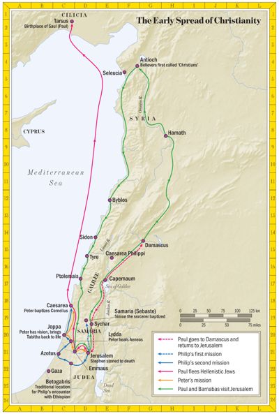 The Early Spread of Christianity 18 places
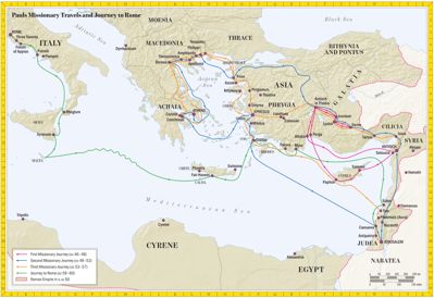 Paul’s Missionary Journeys 60 places
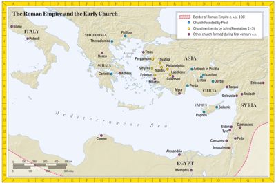 The Roman Empire and the Early Church 34 places
G. A. Smith’s Atlas of the Historical Geography of the Holy Land (1915), 54 maps
 Plate 1 · The Semitic World 9 places
 Plate 2 · Western Asia before 1400 B.C. 0 places
 Plate 3–4 · Empires of the Ancient World 11 places
 Plate 5 · Western Asia in the Fourth to Second Centuries B.C. 10 places
 Plate 6 · The World and Its Races according to the Old Testament 0 places
 Plate 7–8 · Egypt and Sinai Peninsula 6 places
 Plate 9 · Ancient Trade Routes to Palestine 0 places
 Plate 10 · Economic Map of Modern Palestine (1915) 25 places
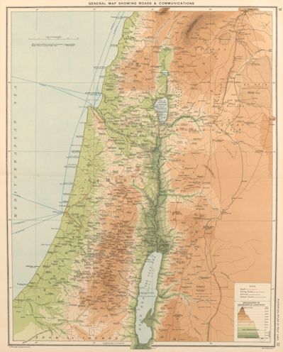 Plate 11–12 · General Orographical Map of Palestine, with Roads and Communications 107 places
 Plate 13 · Geology of Palestine 20 places
 Plate 14 · Vegetation of Palestine 26 places
 Plate 15–16 · Section I. Phoenicia and Lebanon 9 places
 Plate 17–18 · Section II. Anti-Lebanon and Damascus 1 places
 Plate 19–20 · Section III. Galilee 31 places
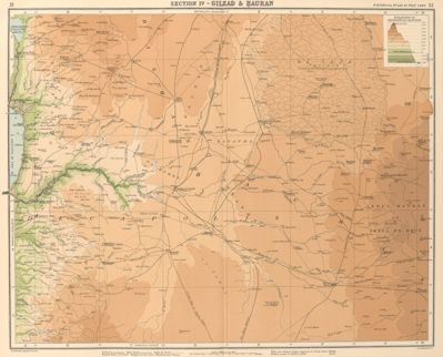 Plate 21–22 · Section IV. Gilead and Hauran 5 places
 Plate 23–24 · Section V. Samaria and Judaea 56 places
 Plate 25–26 · Section VI. South Gilead and Ammon 29 places
 Plate 27–28 · Section VII. Beersheba and the Negeb 21 places
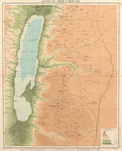 Plate 29–30 · Section VIII. Moab and the Dead Sea 14 places
 Plate 31 · Palestine before the Coming of Israel 49 places
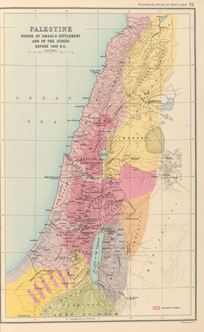 Plate 32 · Period of Israel’s Settlement and of the Judges 52 places
 Plate 33 · Palestine in the Time of Saul 40 places
 Plate 34 · Palestine under David and Solomon 58 places
 Plate 35 · Palestine in the Times of Elijah and Elisha 58 places
 Plate 36 · Palestine from 720 B.C. to the Exile of Judah 55 places
 Plate 37 · Palestine under the Persians 47 places
 Plate 38 · Palestine in the Time of the Maccabees 47 places
 Plate 39 · Palestine in the Time of Alexander Jannaeus and Queen Alexandra 46 places
 Plate 40 · Palestine after Pompey’s Rearrangement 51 places
 Plate 41 · Palestine under Mark Antony 57 places
 Plate 42 · Palestine under Herod the Great 46 places
 Plate 43 · Palestine under Herod’s Will and in the Time of Christ 53 places
 Plate 44 · Palestine in the Time of Agrippa I 38 places
 Plate 45 · Palestine under the Roman Procurators 34 places
 Plate 46 · Palestine in the Time of Agrippa II 43 places
 Plate 47–48 · Jerusalem under David, c. 1000 B.C. 35 places
 Plate 47–48 · Jerusalem under Solomon, c. 970 B.C. 35 places
 Plate 47–48 · Jerusalem under the Later Monarchy and after the Exile 35 places
 Plate 47–48 · Jerusalem in the Time of the Maccabees, 168 B.C. onwards 35 places
 Plate 47–48 · Jerusalem in the Herodian Period 35 places
 Plate 47–48 · Jerusalem: the Three Northern Walls 29 places
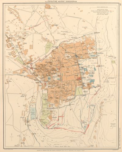 Plate 49–50 · Plan of Modern Jerusalem (1915) 35 places
 Plate 51 · Eastern Mediterranean, to Illustrate St. Paul’s Travels 21 places
 Plate 52 · Asia Minor, Showing the Positions of the Seven Churches 9 places
 Plate 53 · Church and Empire in the East under Trajan, c. 110 A.D. 15 places
 Plate 53a · Church and Empire in the East under Constantine, c. 330 A.D. 6 places
 Plate 54 · Palestine in the Fourth Century, according to Eusebius and Jerome 51 places
 Plate 55 · Palestine after the Peutinger Tables 0 places
 Plate 56 · Palestine after Marinus Sanutus 0 places
 Plate 57 · Syria and Palestine in the Time of the Crusades 8 places
 Plate 58 · Europe and the Nearer East in the Time of the Crusades 0 places
 Plate 58a · Expansion of Christianity 0 places
 Plate 59 · Present Political Divisions of Palestine (1915) 20 places
 Plate 60 · Christian Missions in Palestine 18 places
Tyndale’s Bible maps (2023), 70 maps
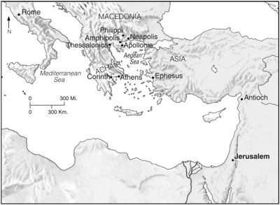 Paul Travels to Macedonia 5 places
 Key Places in 1 Kings 0 places
 The Divided Kingdom 8 places
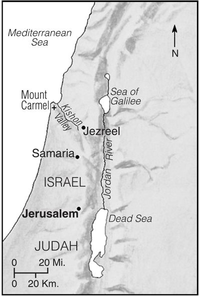 The Showdown at Carmel 0 places
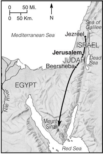 Elijah Flees from Jezebel 4 places
 The Churches of Peter’s First Letter 24 places
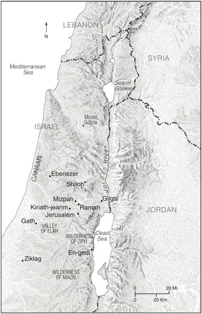 1 Samuel Overview 5 places
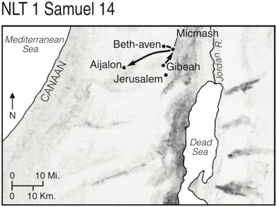 Jonathan Attacks the Philistines (1 Samuel 14) 5 places
 David Flees from Saul 0 places
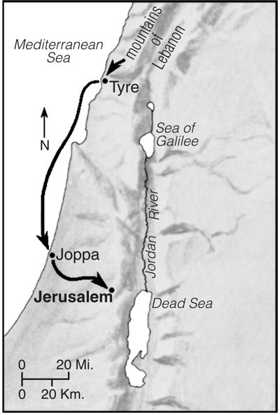 King Hiram Supplies Solomon with Building Materials for the Temple 0 places
 Key Places in 1 and 2 Chronicles 4 places
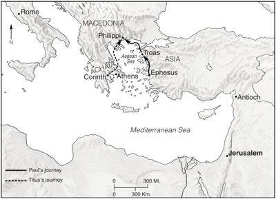 Paul in Troas and Macedonia (2 Corinthians 2:12) 9 places
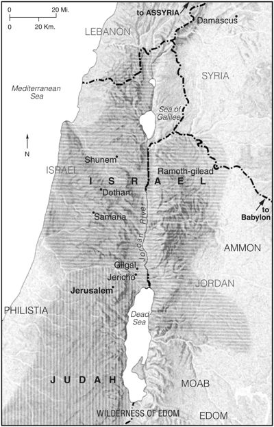 Key Places in 2 Kings 7 places
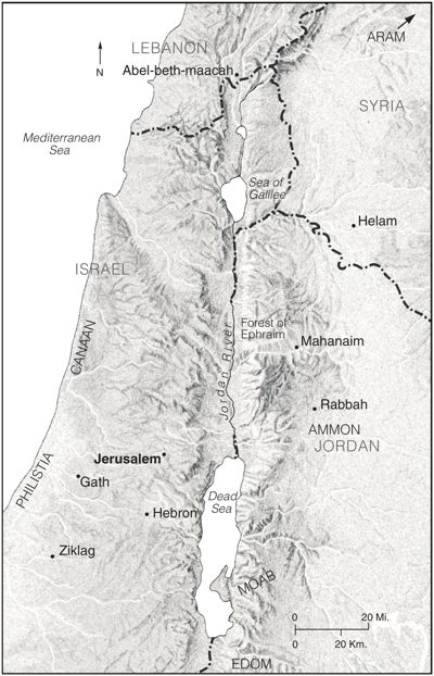 2 Samuel Overview 11 places
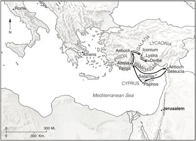 Paul’s First Missionary Journey 14 places
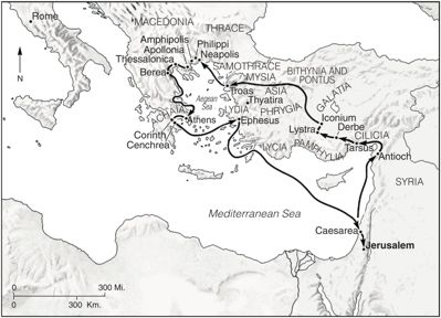 Paul’s Second Missionary Journey 25 places
 Paul’s Third Missionary Journey 33 places
 Paul’s Journey to Rome 19 places
 Paul and Barnabas’s Ministry in Lystra 0 places
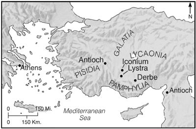 Derbe 0 places
 Paul and Barnabas Travel through Pamphylia at the End of the First Missionary Journey 6 places
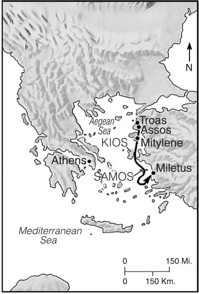 Mitylene 5 places
 Key Places in Acts 35 places
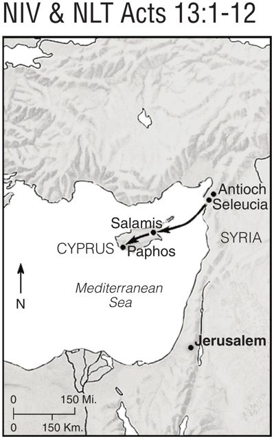 The Beginning of Paul and Barnabas’s First Journey 6 places
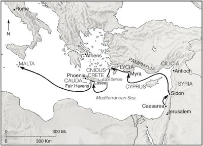 Phoenix, Harbor Town in Crete 18 places
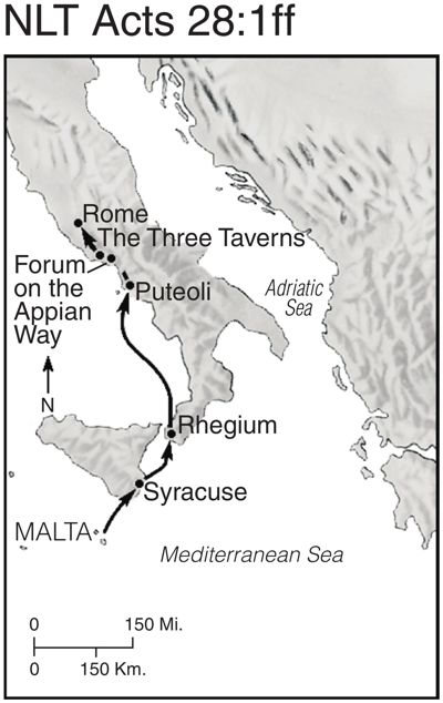 Rhegium 0 places
 Damascus 6 places
 Paul’s Return to Tarsus 0 places
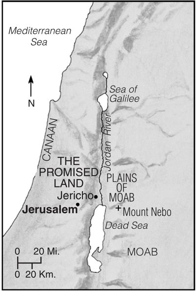 Moab: East of the Promised Land 0 places
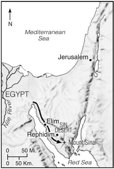 Moses Leads the Israelites to Mount Sinai 0 places
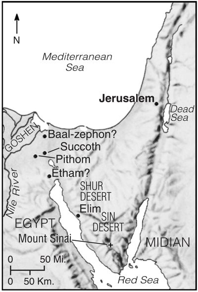 Key Places in the Exodus 6 places
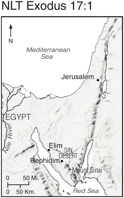 Rephidim 4 places
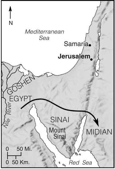 Moses Flees from Egypt to Midian 0 places
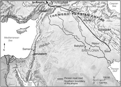 The Medo-Persian Empire 7 places
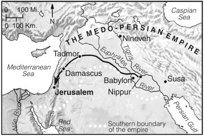 Ezra’s Journey to Jerusalem 0 places
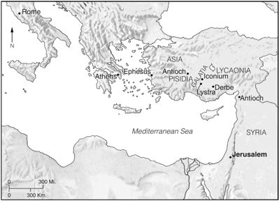 Galatia and the Surrounding Regions 0 places
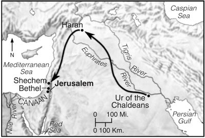 Abram’s Journey to Canaan 0 places
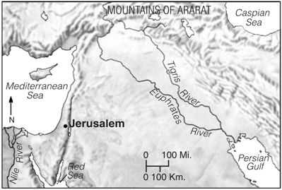 Ararat Mountains 0 places
 Key Places in Genesis 5 places
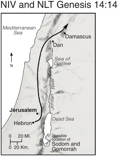 Possible Location of Sodom and Gomorrah 5 places
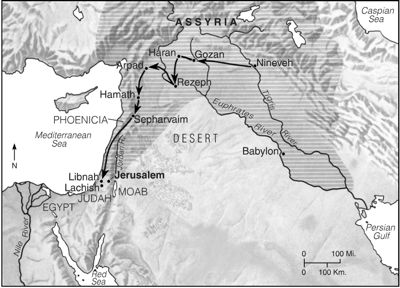 Sennacherib Leads His Troops from Nineveh toward Israel 7 places
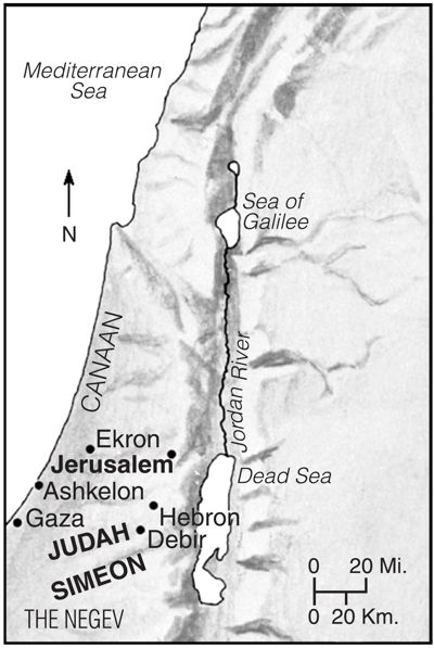 Judah Fights for Its Land 4 places
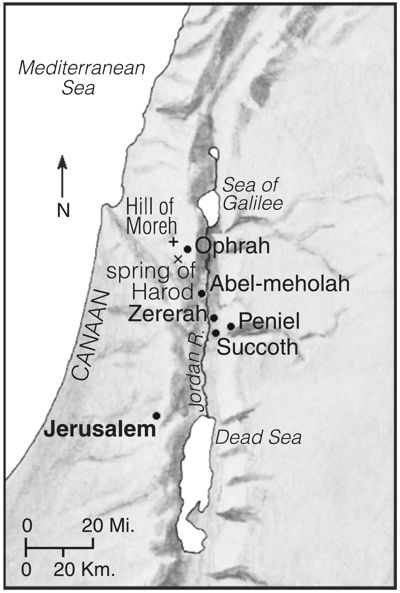 Gideon’s Battle 0 places
 The Garden of Gethsemane 0 places
 Sychar in Samaria 10 places
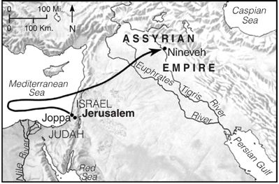 Jonah1 0 places
 Joshua Overview 5 places
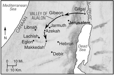 The Battle for Gibeon 5 places
 The Conquered Land 25 places
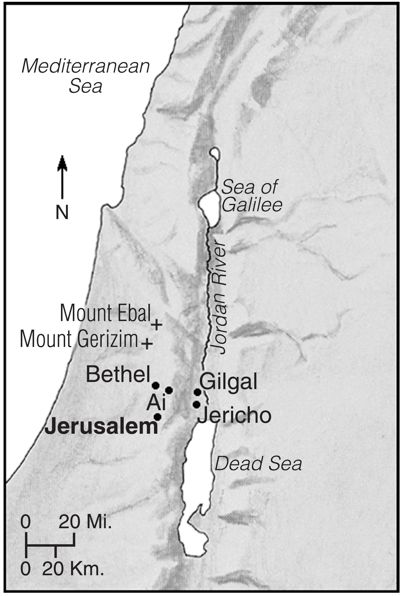 Joshua Conquers Ai 5 places
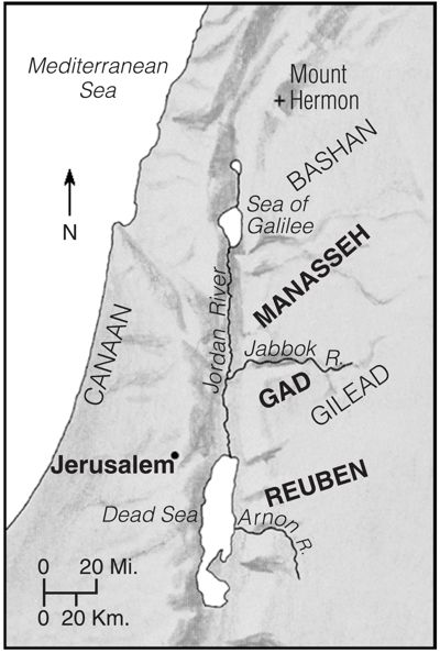 The Tribes East of the Jordan 0 places
 Location of Zebulun 7 places
 Joshua’s Final Days 0 places
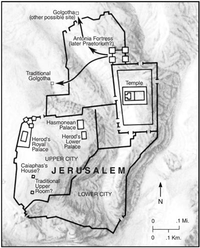 Two Possible Sites for Golgotha 0 places
 Joseph and Mary’s Journey to Bethlehem 0 places
 Important Places in Jesus’ Ministry in Galilee 0 places
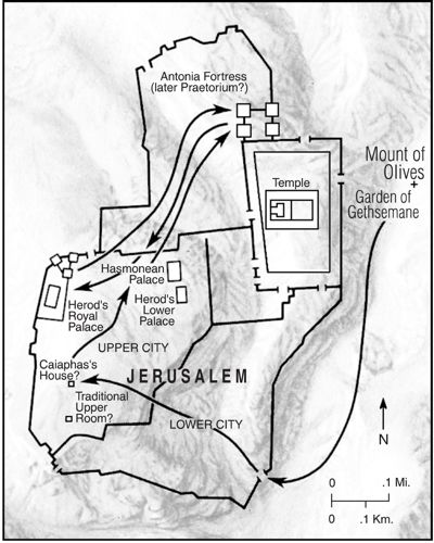 The Last Evening 0 places
 Jesus Travels toward Jerusalem 4 places
 Jesus’ Miraculous Powers Displayed 5 places
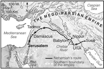 Nehemiah’s Journey to Jerusalem 0 places
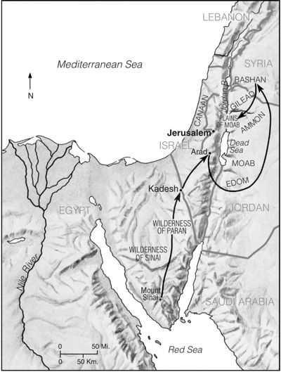 Key Places in Numbers 4 places
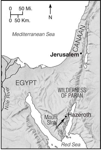 Moses Leads the Israelites toward the Promised Land 0 places
 Valley of Eschol 5 places
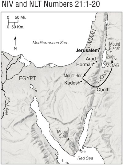 The Israelites Wander in the Wilderness 8 places
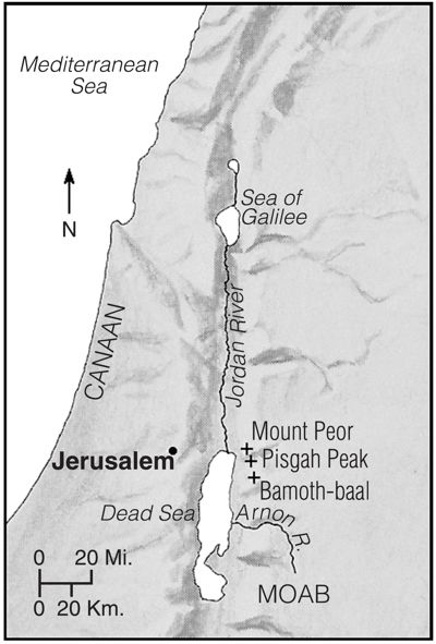 Key Places in the Story of Balaam 5 places
 Cities of Refuge 7 places
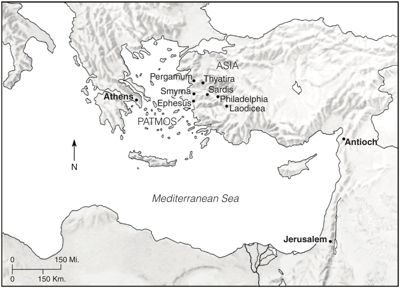 Patmos and the Seven Local Churches in Revelation 12 places
 Illyricum 0 places
 The Story of Ruth 0 places
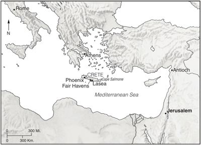 Crete, an Island in the Mediterranean 8 places
Hurlbut’s Bible Atlas (1899), 66 maps
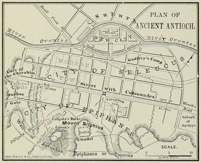 Plan of Ancient Antioch 0 places
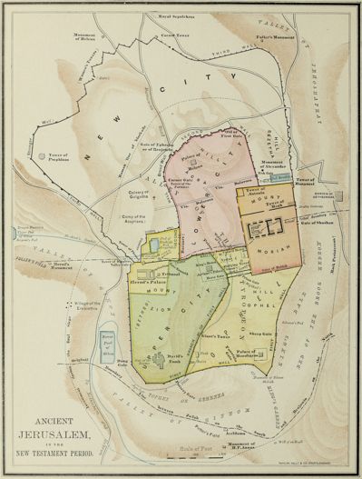 Ancient Jerusalem in the New Testament Period 0 places
 Plan of Ancient Rome 0 places
 The Ancient World and the Descendants of Noah 0 places
 The Assyrian Empire 0 places
 Plan of Athens 0 places
 Babylon 0 places
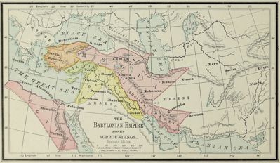 The Babylonian Empire and Its Surroundings 0 places
 Beth-horon and Vicinity 0 places
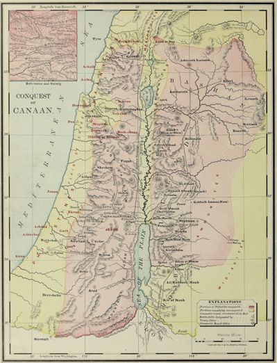 Conquest of Canaan 49 places
 Corinth and Vicinity 0 places
 Map of the Island of Cyprus 0 places
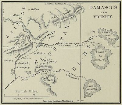 Damascus and Vicinity 0 places
 Division of Alexander’s Empire 0 places
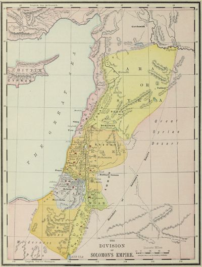 The Division of Solomon’s Empire 0 places
 Early Apostolic History 0 places
 Empire of Amraphel and the East in the Times of Abraham 0 places
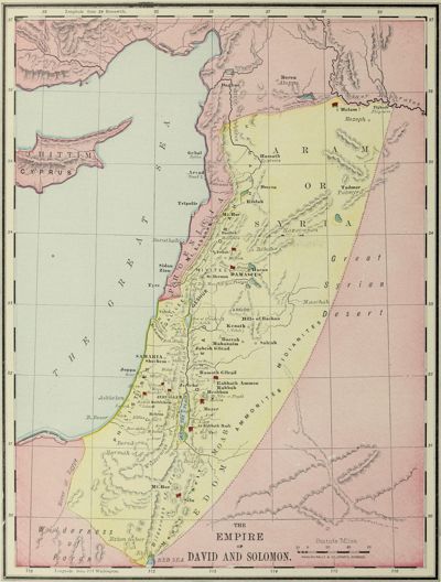 The Empire of David and Solomon 0 places
 Environs of Jerusalem 0 places
 Plan of Ephesus 0 places
 The Isles of Greece and the Seven Churches 0 places
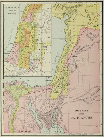 Journeys of the Patriarchs 0 places
 Kadesh-barnea and Vicinity 0 places
 The Kingdom of Egypt at Its Greatest Extent under Rameses II 0 places
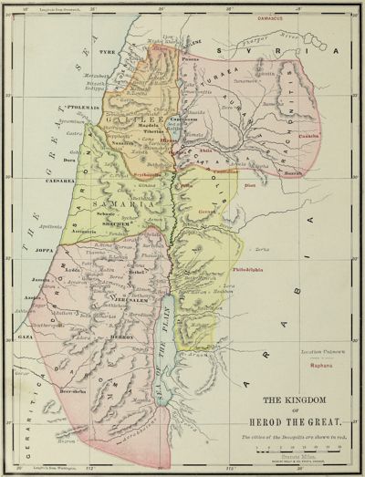 The Kingdom of Herod the Great 29 places
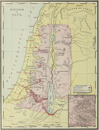 Kingdom of Saul 37 places
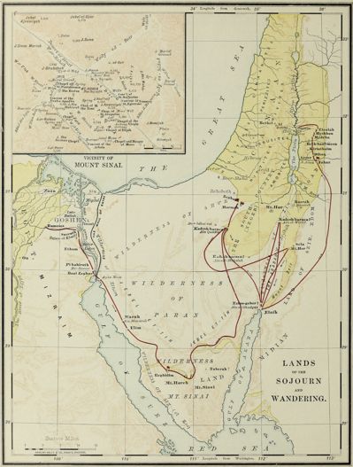 Lands of the Sojourn and Wandering 0 places
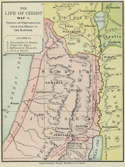 The Life of Christ, Map 1: Period of Preparation 0 places
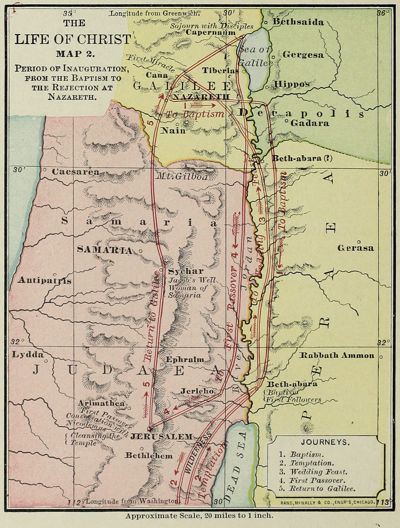 The Life of Christ, Map 2: Period of Inauguration 0 places
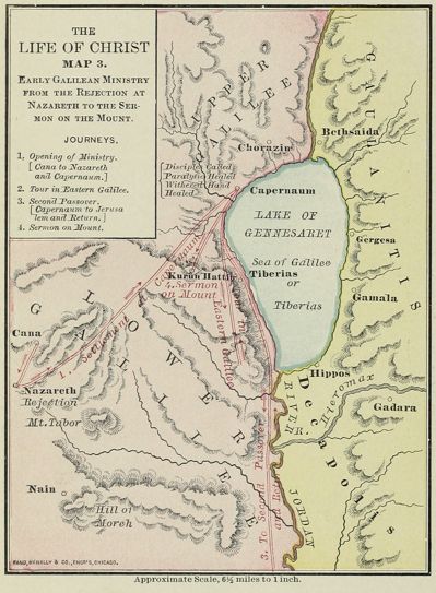 The Life of Christ, Map 3: Early Galilean Ministry 0 places
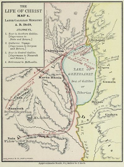 The Life of Christ, Map 4: Later Galilean Ministry 0 places
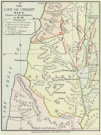 The Life of Christ, Map 5: Period of Retirement 0 places
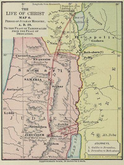 The Life of Christ, Map 6: Period of Judæan Ministry 0 places
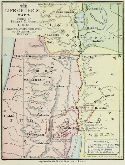 The Life of Christ, Map 7: Period of Peræan Ministry 0 places
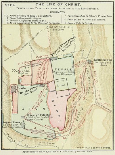 The Life of Christ, Map 8: Period of the Passion 0 places
 Modern Jerusalem (1899) 0 places
 The Modern World and the Bible Lands (1899) 0 places
 Natural Features of Jerusalem 0 places
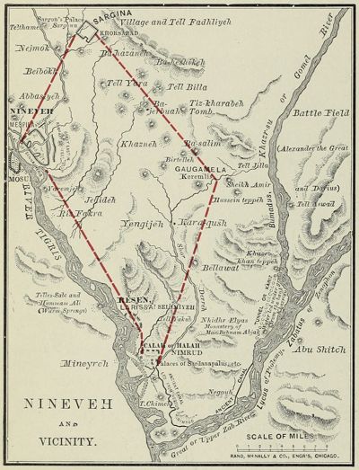 Nineveh and Vicinity 0 places
 The Old Testament World 0 places
 The Oriental World in the Time of David 0 places
 Palestine among the Tribes 85 places
 Palestine as Promised and Possessed 0 places
 Palestine before the Conquest 0 places
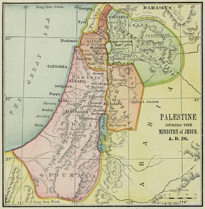 Palestine during the Ministry of Jesus, A.D. 26 0 places
 Palestine under the Judges 46 places
 Palestine under the Maccabees, B.C. 100 0 places
 Map of Palestine and Surrounding Country 0 places
 Isle of Patmos 0 places
 Paul’s First Missionary Journey 0 places
 Paul’s Last Journeys 0 places
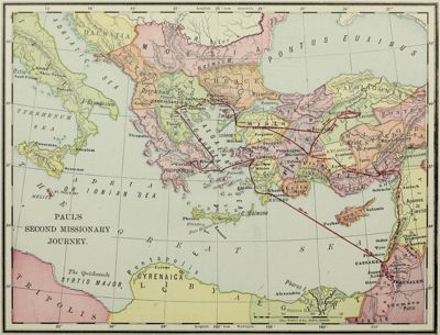 Paul’s Second Missionary Journey 0 places
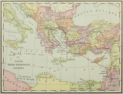 Paul’s Third Missionary Journey 0 places
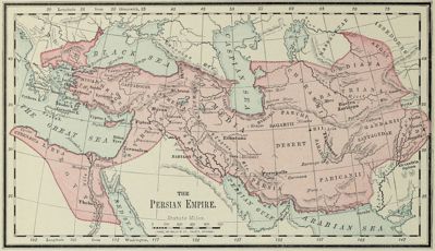 The Persian Empire 0 places
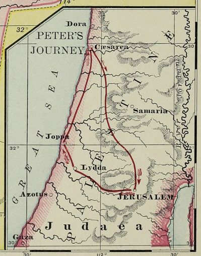 Peter’s Journey 0 places
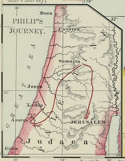 Philip’s Journey 0 places
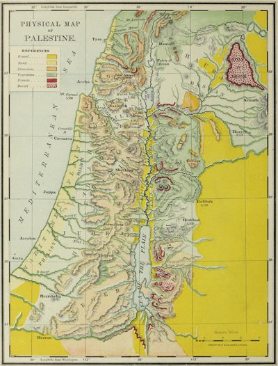 Physical Map of Palestine 19 places
 The Plain of Esdraelon 0 places
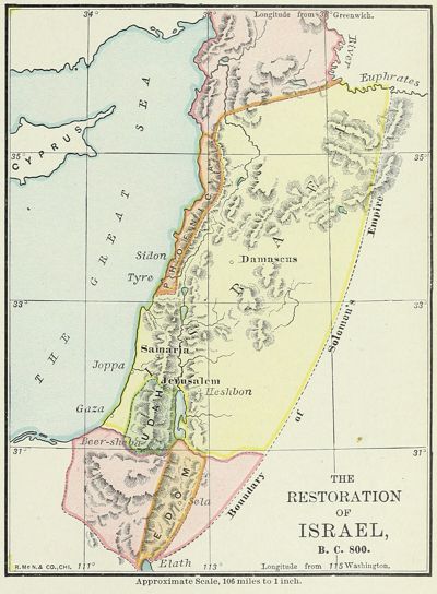 The Restoration of Israel, B.C. 800 0 places
 The Roman Empire in the New Testament Period 0 places
 Saul’s Last Battle 0 places
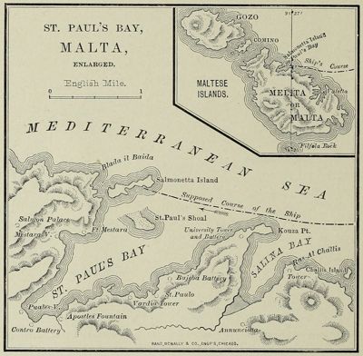 St. Paul’s Bay, Malta 0 places
 The Syrian Period, B.C. 884–840 0 places
 The Two Provinces, A.D. 44–70 0 places
 Vicinity of Mount Sinai 0 places
 Paul’s Voyage to Rome 0 places
The Survey of Western Palestine (1880), 12 maps
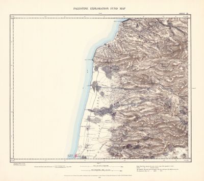 Sheet III · Acre and Achzib 9 places
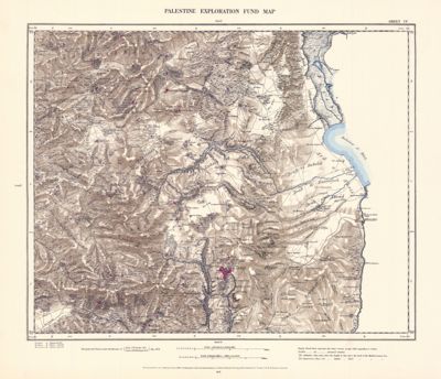 Sheet IV · Safed and Kedesh 17 places
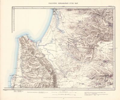 Sheet V · Haifa and Nazareth 36 places
 Sheet VI · Tiberias and Mount Tabor 54 places
 Sheet VIII · Megiddo and Jenin 21 places
 Sheet IX · Beth-shan and Jezreel 22 places
 Sheet XI · Shechem and Samaria 18 places
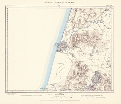 Sheet XIII · Jaffa and Lydda 14 places
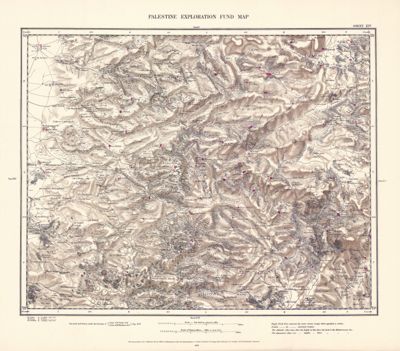 Sheet XIV · Shiloh and Bethel 43 places
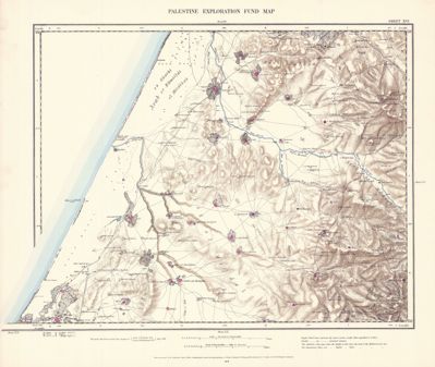 Sheet XVI · Ashdod and Gezer 24 places
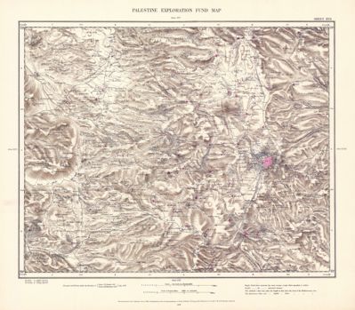 Sheet XVII · Jerusalem and Bethlehem 179 places
 Sheet XXI · Hebron 69 places
Maps: Biblica® Open Bible Maps, Copyright © 2019 by Biblica, Inc. “Biblica” is a trademark registered in the United States Patent and Trademark Office by Biblica, Inc. Used with permission. Licensed under CC BY-SA 4.0; from open.bible, as kept on Wikimedia Commons; shown unmodified, in zoomable tiles. Places and their positions: OpenBible.info Bible Geocoding Data, CC BY 4.0; where each map shows them, read from its labels for Deep Dive Bible.
Maps: George Adam Smith, Atlas of the Historical Geography of the Holy Land, with J. G. Bartholomew (London: Hodder & Stoughton, 1915). Images from the Leonard and Juliet Rothman Holy Lands Map Collection courtesy Stanford University Libraries, CC BY-NC 3.0. Places and their positions: OpenBible.info Bible Geocoding Data, CC BY 4.0; placed on each map by its lines of latitude and longitude, for Deep Dive Bible.
Maps adapted from Tyndale Open Bible Dictionary. The original work by Tyndale House Publishers is available for free at http://www.tyndaleopenresources.com. Copyright © 2023 by Tyndale House Publishers. Licensed under CC BY-SA 4.0. Changed for Deep Dive Bible: each map cut to its frame and made zoomable; places pinned by their labels (OpenBible.info Bible Geocoding Data, CC BY 4.0).
Maps: Jesse Lyman Hurlbut, A Bible Atlas: A Manual of Biblical Geography and History (Chicago: Rand, McNally, 1899). Public domain. Images from the Brigham Young University copy at the Internet Archive.
Maps: the Palestine Exploration Fund’s Map of Western Palestine in 26 Sheets, surveyed by C. R. Conder and H. H. Kitchener, 1872–1877 (Southampton: Ordnance Survey Office, 1880). The site shows 12 of the 26 sheets. Public domain. Images from the National Library of Israel (Eran Laor Cartographic Collection) by way of Wikimedia Commons. Places and their positions: OpenBible.info Bible Geocoding Data, CC BY 4.0; placed on each sheet by landmarks, for Deep Dive Bible.