Maps
Perez-uzzah settlement · 2 verses
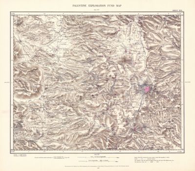 Sheet XVII · Jerusalem and Bethlehem
 Plate 25–26 · Section VI. South Gilead and Ammon (not printed on this map)
 Plate 23–24 · Section V. Samaria and Judaea (not printed on this map)
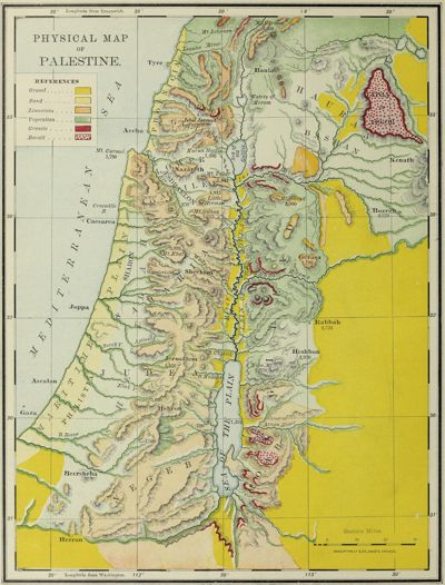 Physical Map of Palestine (not printed on this map)
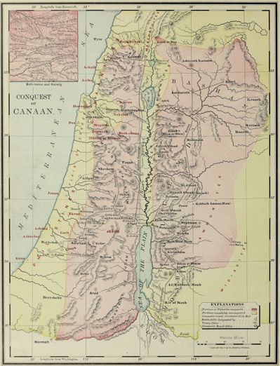 Conquest of Canaan (not printed on this map)
 Palestine under the Judges (not printed on this map)
 Palestine among the Tribes (not printed on this map)
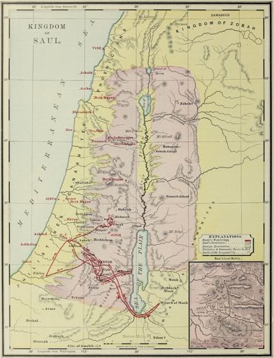 Kingdom of Saul (not printed on this map)
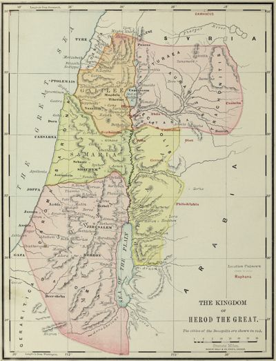 The Kingdom of Herod the Great (not printed on this map)
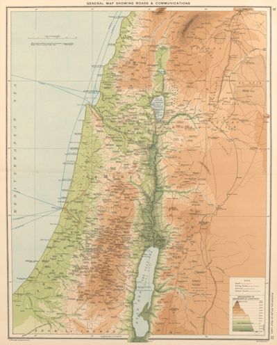 Plate 11–12 · General Orographical Map of Palestine, with Roads and Communications (not printed on this map)
 Plate 13 · Geology of Palestine (not printed on this map)
 Plate 14 · Vegetation of Palestine (not printed on this map)
 Plate 35 · Palestine in the Times of Elijah and Elisha (not printed on this map)
 Plate 41 · Palestine under Mark Antony (not printed on this map)
 Plate 31 · Palestine before the Coming of Israel (not printed on this map)
 Plate 43 · Palestine under Herod’s Will and in the Time of Christ (not printed on this map)
 Plate 45 · Palestine under the Roman Procurators (not printed on this map)
 Plate 59 · Present Political Divisions of Palestine (1915) (not printed on this map)
 Plate 37 · Palestine under the Persians (not printed on this map)
 Plate 39 · Palestine in the Time of Alexander Jannaeus and Queen Alexandra (not printed on this map)
 Plate 33 · Palestine in the Time of Saul (not printed on this map)
 Plate 36 · Palestine from 720 B.C. to the Exile of Judah (not printed on this map)
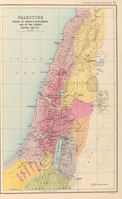 Plate 32 · Period of Israel’s Settlement and of the Judges (not printed on this map)
 Plate 42 · Palestine under Herod the Great (not printed on this map)
 Plate 60 · Christian Missions in Palestine (not printed on this map)
 Plate 46 · Palestine in the Time of Agrippa II (not printed on this map)
 Plate 10 · Economic Map of Modern Palestine (1915) (not printed on this map)
 Plate 44 · Palestine in the Time of Agrippa I (not printed on this map)
 Plate 34 · Palestine under David and Solomon (not printed on this map)
 Plate 38 · Palestine in the Time of the Maccabees (not printed on this map)
 Plate 40 · Palestine after Pompey’s Rearrangement (not printed on this map)
Maps: Biblica® Open Bible Maps, Copyright © 2019 by Biblica, Inc. “Biblica” is a trademark registered in the United States Patent and Trademark Office by Biblica, Inc. Used with permission. Licensed under CC BY-SA 4.0; from open.bible, as kept on Wikimedia Commons. Places: OpenBible.info Bible Geocoding Data, CC BY 4.0, pinned by the map’s own labels.
Maps: George Adam Smith, Atlas of the Historical Geography of the Holy Land, with J. G. Bartholomew (London: Hodder & Stoughton, 1915). Images from the Leonard and Juliet Rothman Holy Lands Map Collection courtesy Stanford University Libraries, CC BY-NC 3.0. Changed for Deep Dive Bible: plates 53 and 58, each printed with two maps, cut in two. Places: OpenBible.info Bible Geocoding Data, CC BY 4.0, pinned by each map’s lines of latitude and longitude.
Maps adapted from Tyndale Open Bible Dictionary. The original work by Tyndale House Publishers is available for free at http://www.tyndaleopenresources.com. Copyright © 2023 by Tyndale House Publishers. Licensed under CC BY-SA 4.0. Changed for Deep Dive Bible: each map cut to its frame. Places: OpenBible.info Bible Geocoding Data, CC BY 4.0, pinned by the map’s own labels.
Maps: Jesse Lyman Hurlbut, A Bible Atlas: A Manual of Biblical Geography and History (Chicago: Rand, McNally, 1899). Public domain. Images from the Brigham Young University copy at the Internet Archive. Changed for Deep Dive Bible: each map cut to its frame; eight maps printed sideways turned north up; the large folding Map of Palestine joined from two scans. Places: OpenBible.info Bible Geocoding Data, CC BY 4.0, pinned on six maps by their lines of latitude and longitude.
Maps: the Palestine Exploration Fund’s Map of Western Palestine in 26 Sheets, surveyed by C. R. Conder and H. H. Kitchener, 1872–1877 (Southampton: Ordnance Survey Office, 1880). The site shows 15 of the 26 sheets. Public domain. Images from the National Library of Israel (Eran Laor Cartographic Collection) by way of Wikimedia Commons. Places: OpenBible.info Bible Geocoding Data, CC BY 4.0, pinned by landmarks on each sheet.